
The History
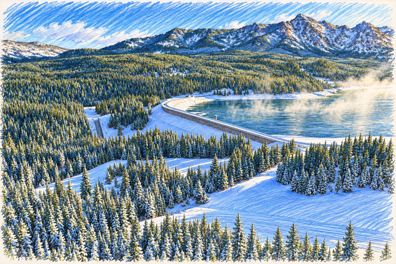
Middle Creek Dam is a 125-foot high, 1900 foot long, earth-fill dam operated by Montana Department of Natural Resources and Conservation located within the Gallatin National Forest approximately 16 miles south of Bozeman, MT. Dam construction was started in 1939 and completed in 1956. Rehabilitation work consisting of raising the embankment 10 feet, replacing the principle spillway, and construction of an auxiliary spillway was completed in 1992 (geotechnical study). The 10,000 acre feet of water covering 490 surface acres held in by the dam is know as Hyalite Reservoir. The reservoir provides irrigation water to 73 farms and drinking water to 2000 residences.


2007 Early Warning System Study
In 2007 Montana Department of Natural Resources and Conservation commissioned a feasibility study to determine if any benefit to the community existed for an Early Warning System to detect a catastrophic failure. This study was completed in 2008 by Water & Earth Technologies, Inc. and determined that an early warning system would benefit the population in the inundation area from the mouth of the canyon to four corners.

In 2008 Gallatin County utilized the results from the feasibility study as justification for a funding request out of the State Homeland Security Grant Program for fiscal year 2008. On September 10, 2008 Gallatin County received an award letter from the State of Montana for $267,206 for the Middle Creek Early Warning System Project.
During 2009 and 2010 (delayed due to endangered species issue) the physical early warning system was installed by Sutron Corporation up Hyalite Canyon. This system was installed with cooperation from the Montana Department of Natural Resources and Conservation (owner of the dam) and the Gallatin National Forest (system is on National Forest System land by Special Use Permit).

Early Warning System
The Middle Creek Early Warning System is designed to provide notification to people who may be in the inundation area as soon as possible. Essentially we are trying to warn people before the water gets to them. To accomplish this the system consists of the physical hardware that monitors for a dam failure, and the combined tools we utilize to warn the community.
The hardware up Hyalite Canyon consists two gauging stations that monitor for water in places it should not be (in the inundation area). Each gauging station has multiple sensors spread out to detect the presence of water. When water is detected this information is sent back by satellite to Gallatin County Emergency Management. Based on the correct sensors being activated, the system is then set into an alarm state which initiates the public warning component of the system.


2017 Study
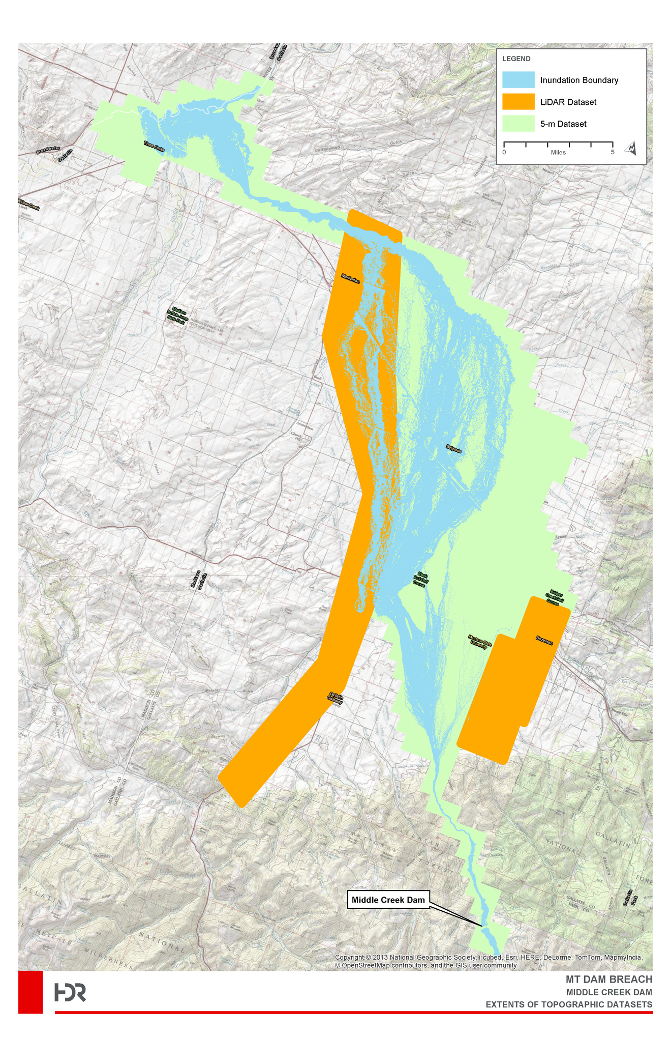
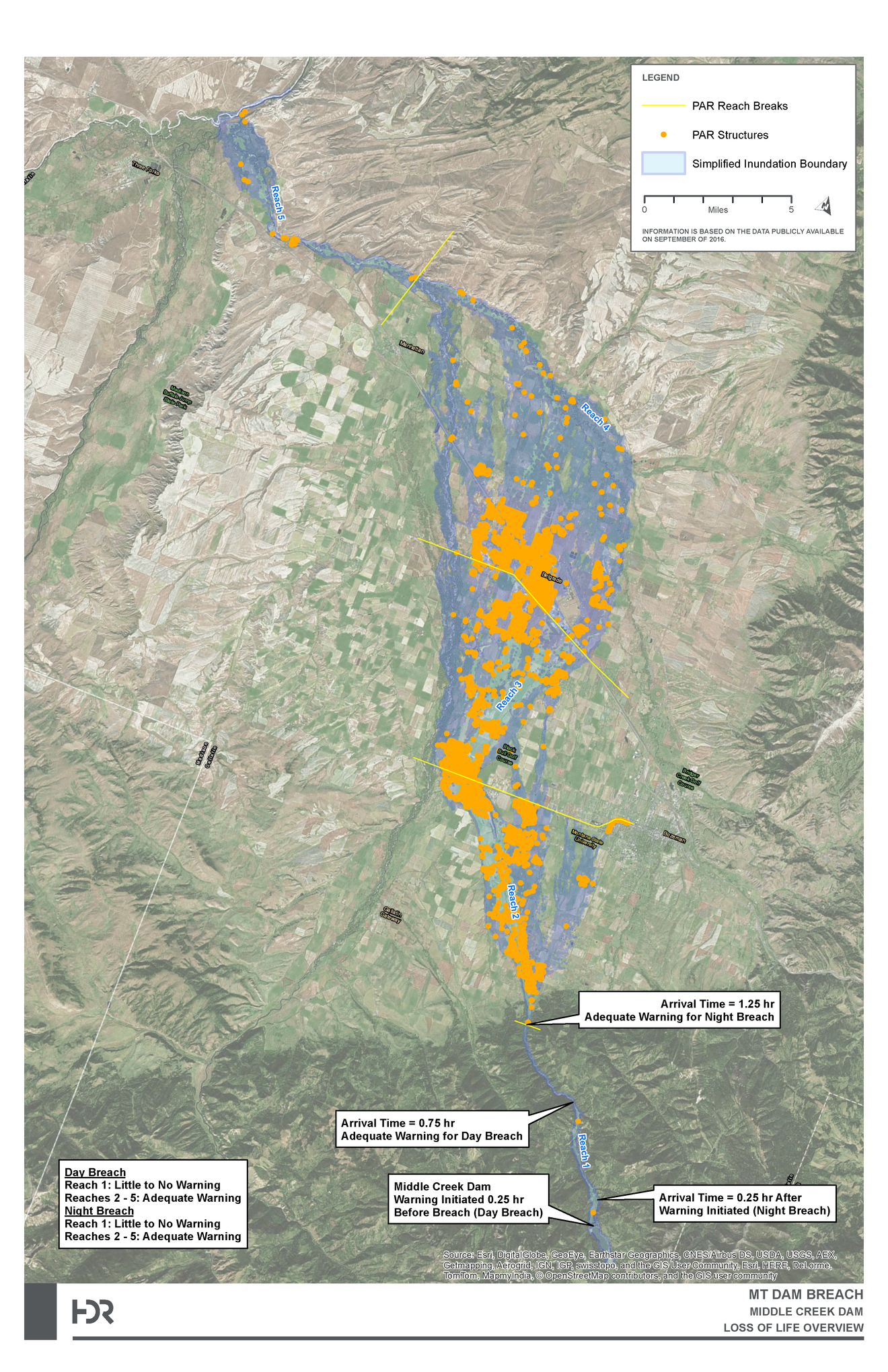
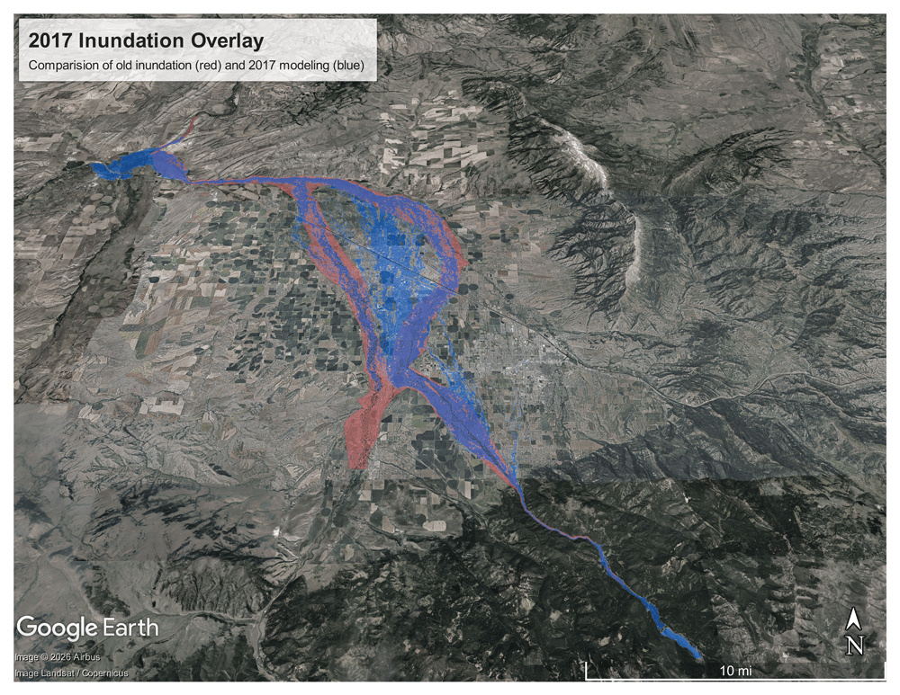
In 2017 the Montana Department of Natural Resources and Conservation hired HDR to conduct a study of Hyalite Reservoir and Middle Creek Dam utilizing modern modeling tools. The more accurate inundation modeling showed a wider continuous inundation area along Jackrabbit through Belgrade compared to the previous modeling that projected Belgrade becoming an island. This is largely due to the use of more detailed LIDAR mapping of the surface terrain in the valley.
Public Alerting
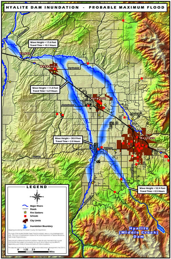
In the event of dam failure of Middle Creek Dam, alerting of the affected community will be implemented in accordance with the Middle Creek Early Warning System Activation Plan. The primary alerting tool is through the Gallatin County Community Notification System using pre-loaded alerting areas and messages. Those in the potential inundation area are encouraged to register in the Community Notification System to ensure rapid and direct notification.
Inundation Arrival Times
| Location | Arrival Time | Peak Time | Max Depth |
| Langhor Campground | 27 Minutes (.45 hr) | 57 Minutes (.95 hr) | 43.7’ |
| S. 19th @ Middle Creek | 77 Minutes (1.28 hr) | 92 Minutes (1.53 hr) | 17.6’ |
| Blackwood Rd @ Middle Creek | 107 Minutes (1.78 hr) | 112 Minutes (1.86 hr) | 4.3’ |
| Huffine & Cottonwood Roads | 132 Minutes (2.2 hr) | 147 Minutes (2.45 hr) | 3.4’ |
| Jackrabbit & Huffine | 117 Minutes (1.95 hr) | 132 Minutes (2.2 hr) | 2.6’ |
| Jackrabbit & Valley Center | 142 Minutes (2.36 hr) | 162 Minutes (2.7 hr) | 5.77’ |
| Jackrabbit @ I-90 | 182 Minutes (3.03 hr) | 202 Minutes (3.36 hr) | 2’ |
| I-90 @ Middle Creek | 172 Minutes (2.86 hr) | 242 Minutes (4.03 hr) | 2.56’ |
| I-90 @ West Gallatin | 292 Minutes (4.86 hr) | 397 Minutes (6.61 hr) | 7.6’ |
| Dry Creek Rd & East Gallatin | 297 Minutes (4.95 hr) | 372 Minutes (6.2 hr) | 6.4’ |
| Nixon Bridge on Gallatin River | 382 Minutes (6.36 hr) | 442 Minutes (7.36 hr) | 11.2’ |
| Railroad Bridge on Gallatin River @ Logan | 457 Minutes (7.61 hr) | 617 Minutes (10.28 hr) | 16.6’ |
| Trident Bridge on Gallatin River | 547 Minutes (9.11 hr) | 927 Minutes (15.45 hr) | 25.8’ |